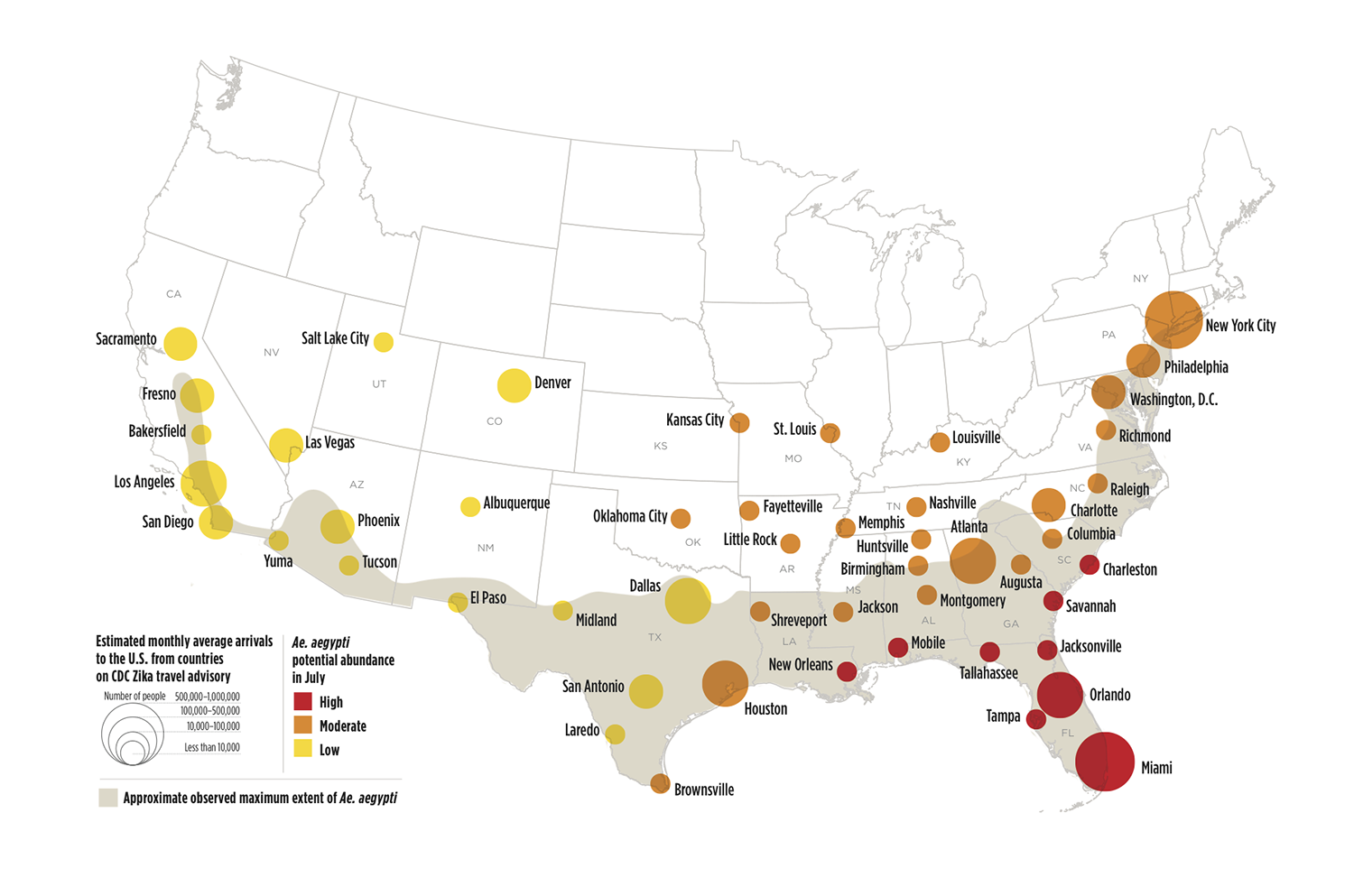
Many U.S. cities face potential risk in summer of low, moderate, or high populations of the mosquito species that transmits Zika virus (colored circles). The mosquito has been observed in parts of the United States (shaded portion of map) and can establish populations in additional cities because of favorable summertime meteorological conditions. In addition, Zika risk may be elevated in cities with more air travelers arriving from Latin America and the Caribbean (larger circles). For a high-resolution map, click here or on the image. (Image based on data mapped by Olga Wilhelmi, NCAR GIS program. This image is freely available for media & nonprofit use.)